On this page:
1. North Dakota Map
2. City of Max Map
1. North Dakota Map
2. City of Max Map
Map of Max from Google Maps, 2015
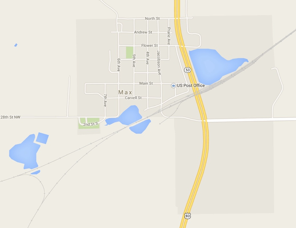
This is a fairly current map of Max and it has changed since the Steinhaus Family lived there.
The Steinhaus Brothers store was located diagonally across Main Street from the Post Office shown on the map at the corner of Main and 2nd Avenue (which is not labeled here--and not to be confused with 2nd St.) The old 2nd Avenue used to extend another block north between the Steinhaus Brothers store and the Steinhaus furniture store.)
The Steinhaus residence is on the left on Jacobson Avenue, in the middle of the third block north of Main Street. Jacobson is a new name for the street.
Elbow Lake shown here to the right of Highway 83 (not 53 as labeled here). It used to extend into the area to the right of Jacobson Ave. Thus in early photos the store backed up to the lake.
